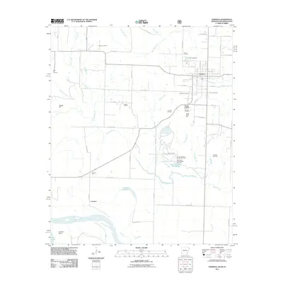
2011 Map of Foreman
USGS Topo · Published 2011About this map
Foreman serves as the primary hub of this Arkansas landscape, where the grid of city streets like W Elm St and Spring St gives way to the agricultural and alluvial plains of Little River County. To the southwest, the Red River meanders toward the border, shaping the lowlands near Lanesport and the isolated John Tom Island. This area is characterized by a dense network of watercourses and managed drainage, including Walnut Bayou and the reservoir systems of M C Jones Lake Number One and Dunbar Lake Dam.
Find a feature on this map
65 named features on this map. Tap any name to fly to it.
Don’t see what you’re looking for? This feature index may not catch every label — zoom into the map to look around manually.
Map Details
Editions of this 2011 Foreman Map
This is the sole edition of this map. No revisions or reprints were ever made.
Other maps of this area

1950 · Redbank
USGS Topo · 1:24,000

1950 · Tom
USGS Topo · 1:24,000

1950 · De Kalb
USGS Topo · 1:24,000

1950 · Winthrop
USGS Topo · 1:24,000

1950 · Bokhoma
USGS Topo · 1:24,000

1951 · De Kalb
USGS Topo · 1:24,000

1951 · Winthrop
USGS Topo · 1:24,000

1951 · Tom
USGS Topo · 1:24,000

1951 · Bokhoma
USGS Topo · 1:24,000

1951 · Redbank
USGS Topo · 1:24,000