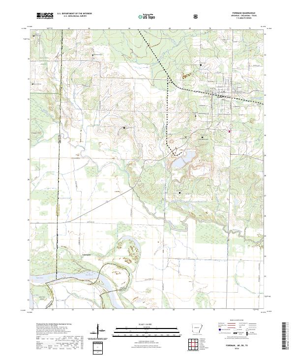
2024 Map of Foreman
USGS Topo · Published 2024About this map
Foreman serves as the central hub of this Little River County landscape, where the street grid meets the rural road network at the junction of Tracy Lawrence Ave and N Madden St. The surrounding terrain is a mosaic of family-named landmarks and historical sites, including several small burial grounds like Dollarhide Cem and the Garland Family Cem. To the west, the map reaches the multi-state borderlands of Arkansas and Oklahoma, defined by the winding course of the Red River and the northern reaches of the Ouachita National Forest. This river-driven geography is shaped by the complex hydrology of Walnut Bayou and French Creek, which meander through the southern lowlands near Lanesport. The area's agricultural and rural character is evident in the numerous small creek branches and the presence of elevated features like Vinegar Hill and Lime Rock Hill.
Find a feature on this map
68 named features on this map. Tap any name to fly to it.
Don’t see what you’re looking for? This feature index may not catch every label — zoom into the map to look around manually.
Map Details
Editions of this 2024 Foreman Map
This is the sole edition of this map. No revisions or reprints were ever made.
Other maps of this area

1950 · Redbank
USGS Topo · 1:24,000

1950 · Tom
USGS Topo · 1:24,000

1950 · De Kalb
USGS Topo · 1:24,000

1950 · Winthrop
USGS Topo · 1:24,000

1950 · Bokhoma
USGS Topo · 1:24,000

1951 · De Kalb
USGS Topo · 1:24,000

1951 · Winthrop
USGS Topo · 1:24,000

1951 · Tom
USGS Topo · 1:24,000

1951 · Bokhoma
USGS Topo · 1:24,000

1951 · Redbank
USGS Topo · 1:24,000