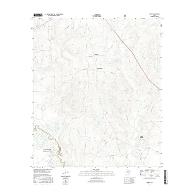
2016 Map of Forest
USGS Topo · Published 2016About this map
The Neches River forms a winding natural boundary between Cherokee and Houston counties, anchoring a landscape defined by the dense woodlands of the Davy Crockett National Forest. This 2016 survey highlights a region shaped by timber and water, where small settlements like Morrill and Brunswick sit amidst an intricate network of creeks, including Sulphur Cr and Larrison Cr. The presence of several family-named landmarks such as Mathis Mill Br and Morrill Fish Pond Br suggests a history of local industry and land management tied to these water sources.
Find a feature on this map
61 named features on this map. Tap any name to fly to it.
Don’t see what you’re looking for? This feature index may not catch every label — zoom into the map to look around manually.
Map Details
Editions of this 2016 Forest Map
This is the sole edition of this map. No revisions or reprints were ever made.
Other maps of this area

1946 · Alto
USGS Topo · 1:62,500

1950 · Kennard NE
USGS Topo · 1:24,000

1950 · Ratcliff
USGS Topo · 1:24,000

1951 · Wells
USGS Topo · 1:24,000

1951 · Kennard NE
USGS Topo · 1:24,000

1951 · Ratcliff
USGS Topo · 1:24,000

1952 · Douglass
USGS Topo · 1:62,500

1953 · Palestine
USGS Topo · 1:250,000

1957 · Palestine
USGS Topo · 1:250,000
1973 · Pryor Mountain
USGS Topo · 1:24,000