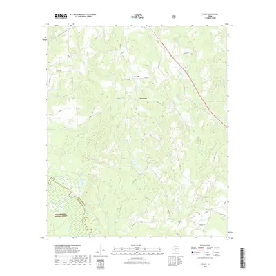
2019 Map of Forest
USGS Topo · Published 2019About this map
The Neches River forms a winding natural boundary between Cherokee and Houston counties, defining a landscape of dense woodlands and seasonal wetlands. Much of the southwestern portion of this map is occupied by the Davy Crockett National Forest, where features like The Whirl, Grassy Pond, and Big Slough reflect the complex hydrology of the river's floodplain. The topography here is characterized by numerous small drainage basins, including Sulphur Cr and Sandy Cr, which feed into the river system.
Find a feature on this map
61 named features on this map. Tap any name to fly to it.
Don’t see what you’re looking for? This feature index may not catch every label — zoom into the map to look around manually.
Map Details
Editions of this 2019 Forest Map
This is the sole edition of this map. No revisions or reprints were ever made.
Other maps of this area

1946 · Alto
USGS Topo · 1:62,500

1950 · Kennard NE
USGS Topo · 1:24,000

1950 · Ratcliff
USGS Topo · 1:24,000

1951 · Wells
USGS Topo · 1:24,000

1951 · Kennard NE
USGS Topo · 1:24,000

1951 · Ratcliff
USGS Topo · 1:24,000

1952 · Douglass
USGS Topo · 1:62,500

1953 · Palestine
USGS Topo · 1:250,000

1957 · Palestine
USGS Topo · 1:250,000
1973 · Pryor Mountain
USGS Topo · 1:24,000