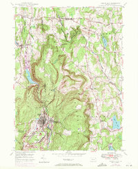
1946 Map of Forest City
USGS Topo · Published 1971About this map
The northern Lackawanna Valley unfolds across this mid-century survey, centered on the industrial and residential grid of Forest City. Positioned at the junction of Susquehanna, Lackawanna, and Wayne counties, the area's landscape is defined by the Erie Lackawanna rail lines that trace the valley floor alongside the West Branch Lackawanna River. The 1969 photorevisions, marked in purple, show significant industrial evolution, specifically highlighting strip mine areas near Richmondale and Vandling.
Find a feature on this map
38 named features on this map. Tap any name to fly to it.
Don’t see what you’re looking for? This feature index may not catch every label — zoom into the map to look around manually.
Map Details
Editions of this 1946 Forest City Map
Other maps of this area

1892 · Honesdale
USGS Topo · 1:62,500

1892 · Dundaff
USGS Topo · 1:62,500

1926 · Starrucca
USGS Topo · 1:62,500

1930 · Starrucca
USGS Topo · 1:48,000

1932 · Susquehanna
USGS Topo · 1:62,500

1933 · Starrucca
USGS Topo · 1:62,500

1935 · Susquehanna
USGS Topo · 1:62,500

1943 · Honesdale
USGS Topo · 1:125,000

1946 · Forest City
USGS Topo · 1:24,000

1946 · Carbondale
USGS Topo · 1:24,000