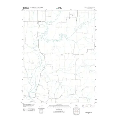
2012 Map of Forest Green
USGS Topo · Published 2012About this map
Shannondale and the surrounding river bottomlands in Chariton County are defined by the winding paths of the Little Chariton River and its multiple forks. This area, captured as it appeared in the early 21st century, shows a rural landscape where small settlements like Forest Green, Oil City, and Lewis Mill anchor a grid of country roads. The hydrology is central to the terrain, featuring distinctive oxbow formations like Horseshoe Lake and Goose Lake alongside the East Fork Little Chariton River.
Find a feature on this map
60 named features on this map. Tap any name to fly to it.
Don’t see what you’re looking for? This feature index may not catch every label — zoom into the map to look around manually.
Map Details
Editions of this 2012 Forest Green Map
This is the sole edition of this map. No revisions or reprints were ever made.
Other maps of this area

1890 · Glasgow
USGS Topo · 1:125,000

1947 · Glasgow
USGS Topo · 1:62,500

1953 · Moberly
USGS Topo · 1:250,000

1953 · Fayette
USGS Topo · 1:24,000

1953 · Armstrong
USGS Topo · 1:24,000

1953 · Clifton Hill
USGS Topo · 1:24,000

1954 · Moberly
USGS Topo · 1:250,000
1956 · Salisbury
USGS Topo · 1:24,000
1956 · Keytesville
USGS Topo · 1:24,000
1956 · Forest Green
USGS Topo · 1:24,000