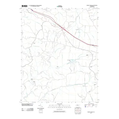
2010 Map of Forest Grove
USGS Topo · Published 2010About this map
Paradise Ridge anchors this portion of northwestern Davidson County, overlooking a complex drainage network where Sycamore Creek and Marrowbone Creek define the local topography. This 2010 landscape reflects a mix of suburban growth and preserved rural character, with family-named landmarks like Gupton Cemetery and Greenville Cemetery providing vital touchpoints for genealogists. The region's hydrography is particularly dense, featuring several small impoundments such as Marrowbone Lake, Lake Louise, and Glen Echo Lake. The presence of Evans Airport and the winding course of the Old Clarksville Pike illustrate the area's transition from historic transit routes to modern transportation needs. Local topography is further marked by distinct features like Crocker Hollow and Pinhook Hill, which have long influenced the placement of residential roads and farms.
Find a feature on this map
81 named features on this map. Tap any name to fly to it.
Don’t see what you’re looking for? This feature index may not catch every label — zoom into the map to look around manually.
Map Details
Editions of this 2010 Forest Grove Map
This is the sole edition of this map. No revisions or reprints were ever made.
Other maps of this area

1903 · Nashville
USGS Topo · 1:125,000

1930 · White Bluff
USGS Topo · 1:62,500

1931 · Ridgetop
USGS Topo · 1:62,500

1932 · Nashville
USGS Topo · 1:62,500

1933 · White Bluff
USGS Topo · 1:62,500

1935 · Ridgetop
USGS Topo · 1:62,500

1952 · Nashville West
USGS Topo · 1:24,000

1955 · Whites Creek
USGS Topo · 1:24,000

1955 · Forest Grove
USGS Topo · 1:24,000

1955 · Scottsboro
USGS Topo · 1:24,000