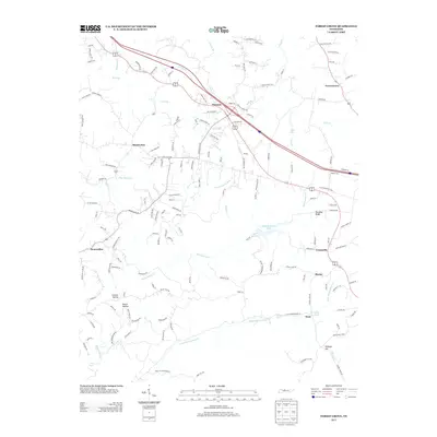
2013 Map of Forest Grove
USGS Topo · Published 2013About this map
Paradise Ridge rises above a landscape defined by the winding drainages of Marrowbone Cr and Little Marrowbone Cr in this rural area northwest of Nashville. The map documents a transition from the wooded terrain of Crocker Hollow and Beech Hollow to established local settlements like Mount Zion, Bearwallow, and Forest Grove. Subdivisions and residential roads like Green Acres Rd and Settlers Xing appear alongside more established routes, illustrating the encroaching modern development upon the traditional farming landscape.
Find a feature on this map
150 named features on this map. Tap any name to fly to it.
Don’t see what you’re looking for? This feature index may not catch every label — zoom into the map to look around manually.
Map Details
Editions of this 2013 Forest Grove Map
This is the sole edition of this map. No revisions or reprints were ever made.
Other maps of this area

1903 · Nashville
USGS Topo · 1:125,000

1930 · White Bluff
USGS Topo · 1:62,500

1931 · Ridgetop
USGS Topo · 1:62,500

1932 · Nashville
USGS Topo · 1:62,500

1933 · White Bluff
USGS Topo · 1:62,500

1935 · Ridgetop
USGS Topo · 1:62,500

1952 · Nashville West
USGS Topo · 1:24,000

1955 · Whites Creek
USGS Topo · 1:24,000

1955 · Forest Grove
USGS Topo · 1:24,000

1955 · Scottsboro
USGS Topo · 1:24,000