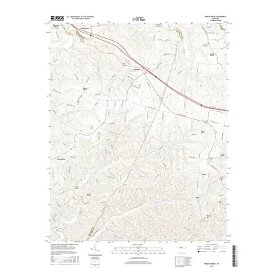
2016 Map of Forest Grove
USGS Topo · Published 2016About this map
Paradise Ridge and the winding reaches of Marrowbone Creek define the complex topography where Davidson, Cheatham, and Robertson counties meet. This 2016 survey shows a landscape of deep hollows like Crocker Hollow and Beech Hollow alongside established hilltop communities. The area is marked by a network of rural routes such as the Old Clarksville Pike and Big Marrowbone Road, which navigate the elevation changes around Pinhook Hill and Bear Hollow. Local heritage is anchored by scattered burial grounds, including Gupton Cemetery near Mount Zion and Greenville Cemetery further east. The presence of multiple reservoirs, including Marrowbone Lake and Lake Louise, indicates the importance of water management and recreation in this drainage basin. Small settlements such as Morny, Bearwallow, and Pinnacle are interconnected by these ridge-top roads, reflecting the historical settlement patterns of the Highland Rim.
Find a feature on this map
124 named features on this map. Tap any name to fly to it.
Don’t see what you’re looking for? This feature index may not catch every label — zoom into the map to look around manually.
Map Details
Editions of this 2016 Forest Grove Map
This is the sole edition of this map. No revisions or reprints were ever made.
Other maps of this area

1903 · Nashville
USGS Topo · 1:125,000

1930 · White Bluff
USGS Topo · 1:62,500

1931 · Ridgetop
USGS Topo · 1:62,500

1932 · Nashville
USGS Topo · 1:62,500

1933 · White Bluff
USGS Topo · 1:62,500

1935 · Ridgetop
USGS Topo · 1:62,500

1952 · Nashville West
USGS Topo · 1:24,000

1955 · Whites Creek
USGS Topo · 1:24,000

1955 · Forest Grove
USGS Topo · 1:24,000

1955 · Scottsboro
USGS Topo · 1:24,000