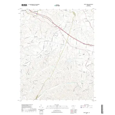
2019 Map of Forest Grove
USGS Topo · Published 2019About this map
Paradise Ridge and the winding course of Marrowbone Cr define the landscape of this Tennessee region northwest of Nashville. The terrain is marked by a series of deep hollows, including Crocker Hollow, Beech Hollow, and Nickens Hollow, which historically dictated the movement of travel and settlement. Rural communities such as Mount Zion, Bearwallow, and Morny are connected by a network of established routes like the Old Clarksville Pike. Family history is anchored in the landscape through numerous small burial grounds, notably Gupton Cem, Forest Grove Cem, and Oakland Cem. The presence of several impounded water bodies, including Lake Louise, Setters Lake, and Glen Echo Lake, reflects the intersection of natural drainage and modern land management in this hilly portion of the Highland Rim.
Find a feature on this map
137 named features on this map. Tap any name to fly to it.
Don’t see what you’re looking for? This feature index may not catch every label — zoom into the map to look around manually.
Map Details
Editions of this 2019 Forest Grove Map
This is the sole edition of this map. No revisions or reprints were ever made.
Other maps of this area

1903 · Nashville
USGS Topo · 1:125,000

1930 · White Bluff
USGS Topo · 1:62,500

1931 · Ridgetop
USGS Topo · 1:62,500

1932 · Nashville
USGS Topo · 1:62,500

1933 · White Bluff
USGS Topo · 1:62,500

1935 · Ridgetop
USGS Topo · 1:62,500

1952 · Nashville West
USGS Topo · 1:24,000

1955 · Whites Creek
USGS Topo · 1:24,000

1955 · Forest Grove
USGS Topo · 1:24,000

1955 · Scottsboro
USGS Topo · 1:24,000