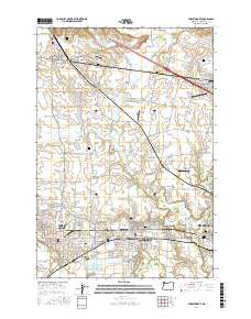
2017 Map of Forest Grove
USGS Topo · Published 2017About this map
Forest Grove and Cornelius anchor this detailed study of the Tualatin Valley, where suburban growth meets the agricultural heart of Washington County. The landscape is defined by the winding paths of Dairy Cr and the Tualatin River, alongside numerous irrigation reservoirs like Verboort Reservoir and Council Reservoir. The area maintains a high density of historical sites, particularly through its network of cemeteries including Fir Lawn Cem and the Hillsboro Pioneer Cem on the edge of Hillsboro. Transport infrastructure is prominent, featuring the Portland & Western RR corridor and several small aviation sites such as Skyport Airport and Olinger Airpark. The map preserves the footprint of smaller communities like Verboort and Wilkesboro, illustrating how rural crossroads and religious landmarks like Visitation Ch continue to shape the regional character amidst expanding municipal boundaries.
Find a feature on this map
134 named features on this map. Tap any name to fly to it.
Don’t see what you’re looking for? This feature index may not catch every label — zoom into the map to look around manually.
Map Details
Editions of this 2017 Forest Grove Map
This is the sole edition of this map. No revisions or reprints were ever made.
Other maps of this area

1915 · Hillsboro
USGS Topo · 1:62,500

1916 · Tualatin
USGS Topo · 1:62,500

1918 · Hillsboro
USGS Topo · 1:62,500

1939 · Tualatin
USGS Topo · 1:62,500

1940 · Tualatin
USGS Topo · 1:62,500

1940 · Hillsboro
USGS Topo · 1:62,500

1941 · Gales Creek
USGS Topo · 1:62,500

1941 · Yamhill
USGS Topo · 1:62,500

1942 · Yamhill
USGS Topo · 1:62,500

1948 · Vancouver
USGS Topo · 1:250,000