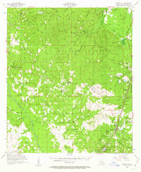
1956 Map of Forest Hill
USGS Topo · Published 1962About this map
Kisatchie National Forest and Alexander State Forest dominate the central and eastern portions of this mid-century survey, creating a landscape defined by timber and public lands. In the southeast corner, the towns of Forest Hill and Longleaf sit along the Missouri Pacific railroad, serving as hubs for local commerce. Smaller communities like Elmer and Melder are connected by a network of rural roads that cross numerous watercourses, including Castor Creek and Boggy Bayou.
Find a feature on this map
100 named features on this map. Tap any name to fly to it.
Don’t see what you’re looking for? This feature index may not catch every label — zoom into the map to look around manually.
Map Details
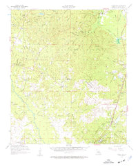
Editions of this 1956 Forest Hill Map
3 editions found

Other maps of this area

1932 · Boyce SW
USGS Topo · 1:31,680

1935 · Pawnee
USGS Topo · 1:31,680

1935 · Turkey Creek
USGS Topo · 1:62,500

1935 · Lecompte
USGS Topo · 1:62,500

1937 · Chopin SE
USGS Topo · 1:31,680

1941 · Alexandria
USGS Topo · 1:62,500

1941 · Boyce
USGS Topo · 1:62,500

1942 · Oakdale
USGS Topo · 1:62,500

1943 · Leander
USGS Topo · 1:62,500

1944 · Chopin
USGS Topo · 1:62,500