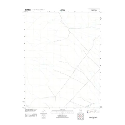
2012 Map of Forest Home NE
USGS Topo · Published 2012About this map
Lower Perish Spring serves as a vital water source in this high-desert region of Nye County, where the landscape is defined by drainage patterns and intermittent water sources. The 2012 topography shows a remote area primarily managed for natural resources and grazing, evidenced by the passage of Forest Rd 410 through the central part of the quadrangle. In the southeastern corner, the Forest Home Reservoir Number 5 represents one of the few managed hydrological features, highlighting the ongoing human efforts to capture and utilize the limited water runoff in this arid environment.
Find a feature on this map
3 named features on this map. Tap any name to fly to it.
Don’t see what you’re looking for? This feature index may not catch every label — zoom into the map to look around manually.
Map Details
Editions of this 2012 Forest Home NE Map
This is the sole edition of this map. No revisions or reprints were ever made.
Other maps of this area

1956 · Lund
USGS Topo · 1:250,000

1960 · Lund
USGS Topo · 1:250,000

1964 · Currant
USGS Topo · 1:62,500

1964 · Forest Home
USGS Topo · 1:62,500

1969 · Hot Creek Butte
USGS Topo · 1:24,000

1969 · Sunnyside NW
USGS Topo · 1:24,000

1969 · Moorman Spring
USGS Topo · 1:24,000

1980 · Duckwater
USGS Topo · 1:100,000

1988 · Quinn Canyon Range
USGS Topo · 1:100,000
1990 · Wells Station
USGS Topo · 1:24,000