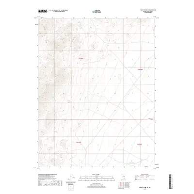
2018 Map of Forest Home NE
USGS Topo · Published 2018About this map
White River Valley defines the eastern portion of this Nye County quadrangle, where the arid basin floor meets the rising terrain of the Great Basin. This 2018 survey documents a landscape focused on critical water management in a high-desert environment, anchored by Forest Home Reservoir Number 5 in the southeast. The map illustrates the sparse distribution of water sources, such as Lower Perish Spring in the north and the intermittent drainage of Sandy Wash. These isolated features indicate the historical and contemporary importance of water rights and livestock management in this part of Nevada, where public land boundaries like t7n r59e and t6n r60e segment the open range.
Find a feature on this map
8 named features on this map. Tap any name to fly to it.
Don’t see what you’re looking for? This feature index may not catch every label — zoom into the map to look around manually.
Map Details
Editions of this 2018 Forest Home NE Map
This is the sole edition of this map. No revisions or reprints were ever made.
Other maps of this area

1956 · Lund
USGS Topo · 1:250,000

1960 · Lund
USGS Topo · 1:250,000

1964 · Currant
USGS Topo · 1:62,500

1964 · Forest Home
USGS Topo · 1:62,500

1969 · Hot Creek Butte
USGS Topo · 1:24,000

1969 · Sunnyside NW
USGS Topo · 1:24,000

1969 · Moorman Spring
USGS Topo · 1:24,000

1980 · Duckwater
USGS Topo · 1:100,000

1988 · Quinn Canyon Range
USGS Topo · 1:100,000
1990 · Wells Station
USGS Topo · 1:24,000