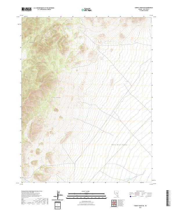
2021 Map of Forest Home NE
USGS Topo · Published 2021About this map
The Grant Range dominates the western portion of this landscape, its steep contours transitioning sharply into the broad expanse of the White River Valley to the east. This transition zone is marked by drainage patterns like Sandy Wash, which channel seasonal water from the high ridges down toward the valley floor. In the lower elevations, water resources are sparse and concentrated, exemplified by the presence of Lower Perish Spring and the Forest Home Reservoir Number 5 at the southern edge of the quadrangle. These features point to the critical role of water management in a high-desert environment where topography dictates land use and accessibility. The map provides a clear record of the public land survey system divisions across Nye County, showing the intersection of t7n r59e, t7n r60e, t6n r59e, and t6n r60e.
Find a feature on this map
9 named features on this map. Tap any name to fly to it.
Don’t see what you’re looking for? This feature index may not catch every label — zoom into the map to look around manually.
Map Details
Editions of this 2021 Forest Home NE Map
This is the sole edition of this map. No revisions or reprints were ever made.
Other maps of this area

1956 · Lund
USGS Topo · 1:250,000

1960 · Lund
USGS Topo · 1:250,000

1964 · Currant
USGS Topo · 1:62,500

1964 · Forest Home
USGS Topo · 1:62,500

1969 · Hot Creek Butte
USGS Topo · 1:24,000

1969 · Sunnyside NW
USGS Topo · 1:24,000

1969 · Moorman Spring
USGS Topo · 1:24,000

1980 · Duckwater
USGS Topo · 1:100,000

1988 · Quinn Canyon Range
USGS Topo · 1:100,000
1990 · Wells Station
USGS Topo · 1:24,000