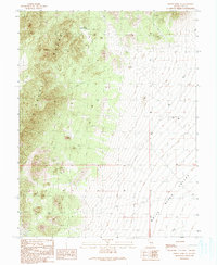
1990 Map of Forest Home NE
USGS Topo · Published 1990About this map
The Grant Range dominates the western landscape of this 1990 survey, rising sharply above the expansive White River Valley to the east. This transition from high mountain terrain to the valley floor is punctuated by vital water sources such as Lower Perish Spring and a simple Spring near the base of the foothills. The rugged character of the area is reflected in its limited infrastructure, consisting primarily of 4wd tracks and a few isolated landmarks like the Moon River Basin Well.
Find a feature on this map
11 named features on this map. Tap any name to fly to it.
Don’t see what you’re looking for? This feature index may not catch every label — zoom into the map to look around manually.
Map Details
Editions of this 1990 Forest Home NE Map
This is the sole edition of this map. No revisions or reprints were ever made.
Other maps of this area

1956 · Lund
USGS Topo · 1:250,000

1960 · Lund
USGS Topo · 1:250,000

1964 · Currant
USGS Topo · 1:62,500

1964 · Forest Home
USGS Topo · 1:62,500

1969 · Hot Creek Butte
USGS Topo · 1:24,000

1969 · Sunnyside NW
USGS Topo · 1:24,000

1969 · Moorman Spring
USGS Topo · 1:24,000

1980 · Duckwater
USGS Topo · 1:100,000

1988 · Quinn Canyon Range
USGS Topo · 1:100,000
1990 · Wells Station
USGS Topo · 1:24,000