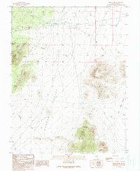
1990 Map of Forest Home
USGS Topo · Published 1990About this map
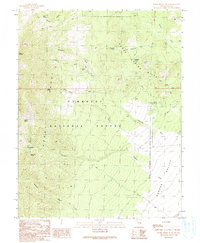
Forest Home sits at the junction of water-management efforts and the arid terrain of northern Nye County. This 1990 provisional study captures a landscape defined by seasonal water flow and ranching infrastructure, evidenced by the Home Ditch and numerous unnamed ditches that distribute water from Big Spring Creek across the high desert floor. The map illustrates a transition between major geological features, where the eastern slopes of the Horse Spring Hills meet the expansive Garden Valley. To the south and east, the Gate Range rises abruptly, overlooking the White River Valley. Numerous dry washes like Teaspoon Wash and Sherwood Wash suggest a landscape shaped by intermittent flash flooding, while a Gravel Pit and scattered 4wd tracks indicate limited but active human use of this remote basin during the late twentieth century.
Find a feature on this map
18 named features on this map. Tap any name to fly to it.
Don’t see what you’re looking for? This feature index may not catch every label — zoom into the map to look around manually.
Map Details
Editions of this 1990 Forest Home Map
This is the sole edition of this map. No revisions or reprints were ever made.
Other maps of this area

1956 · Lund
USGS Topo · 1:250,000

1960 · Lund
USGS Topo · 1:250,000

1964 · Forest Home
USGS Topo · 1:62,500

1969 · Hot Creek Butte
USGS Topo · 1:24,000

1969 · Sunnyside NW
USGS Topo · 1:24,000
1971 · Timber Mtn Pass NW
USGS Topo · 1:24,000
1985 · Water Gap NW
USGS Topo · 1:24,000
1985 · Water Gap NE
USGS Topo · 1:24,000

1988 · Quinn Canyon Range
USGS Topo · 1:100,000
1990 · Horse Spring Hills
USGS Topo · 1:24,000