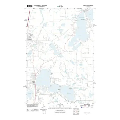
2010 Map of Forest Lake
USGS Topo · Published 2010About this map
The Sunrise River and its multiple branches weave through a landscape defined by an extensive network of glacial lakes in this 2010 survey of the Chisago and Washington County borderlands. The city of Forest Lake serves as a major hub at the southern end of its namesake water body, while Chisago City and Wyoming anchor the northern and western reaches. This era shows a well-established recreational and residential infrastructure, featuring unique aviation landmarks like the Waldref Seaplane Base on the northern shore of Forest Lake and Dupres Airport to the east.
Find a feature on this map
96 named features on this map. Tap any name to fly to it.
Don’t see what you’re looking for? This feature index may not catch every label — zoom into the map to look around manually.
Map Details
Editions of this 2010 Forest Lake Map
This is the sole edition of this map. No revisions or reprints were ever made.
Other maps of this area

1902 · White Bear
USGS Topo · 1:62,500

1948 · Stillwater
USGS Topo · 1:62,500

1949 · Stillwater
USGS Topo · 1:62,500

1952 · Centerville
USGS Topo · 1:24,000

1953 · Stillwater
USGS Topo · 1:250,000

1954 · Hugo
USGS Topo · 1:24,000

1955 · Marine
USGS Topo · 1:24,000

1955 · Forest Lake
USGS Topo · 1:62,500

1955 · Isanti
USGS Topo · 1:62,500
1955 · New Brighton
USGS Topo · 1:62,500