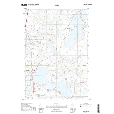
2019 Map of Forest Lake
USGS Topo · Published 2019About this map
Chisago County and Washington County meet amidst a dense network of glacial basins and residential corridors in this 2019 survey. The area is defined by its namesake Forest Lake, which serves as a central hub for the communities of Wyoming and Forest Lake. To the north, the Sunrise River meanders toward Stacy, while the larger water bodies of Green Lake and Little Green Lake frame the settlement of Chisago City.
Find a feature on this map
131 named features on this map. Tap any name to fly to it.
Don’t see what you’re looking for? This feature index may not catch every label — zoom into the map to look around manually.
Map Details
Editions of this 2019 Forest Lake Map
This is the sole edition of this map. No revisions or reprints were ever made.
Other maps of this area

1902 · White Bear
USGS Topo · 1:62,500

1948 · Stillwater
USGS Topo · 1:62,500

1949 · Stillwater
USGS Topo · 1:62,500

1952 · Centerville
USGS Topo · 1:24,000

1953 · Stillwater
USGS Topo · 1:250,000

1954 · Hugo
USGS Topo · 1:24,000

1955 · Marine
USGS Topo · 1:24,000

1955 · Forest Lake
USGS Topo · 1:62,500

1955 · Isanti
USGS Topo · 1:62,500
1955 · New Brighton
USGS Topo · 1:62,500