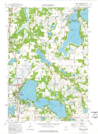
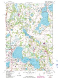
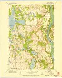
1974 Map of Forest Lake
USGS Topo · Published 1976About this map
Forest Lake and the surrounding chain of water bodies define this mid-1970s landscape, illustrating a transition from agriculture toward recreation and suburban growth. The sheet detail covers several established lakefront communities, including Chisago City and Wyoming, where the Burlington Northern railroad corridor runs parallel to the developing highway network. To the northwest, the Carlos Avery State Wildlife Management Area preserves a significant portion of the original marshy terrain, while elsewhere, the expansion of amenities like the Castlewood Country Club and a Drive-in Theater reflects the era's changing land use. Local history is well-preserved through numerous community landmarks, ranging from the Scandinavian Cemetery and Cedar Hill Cemetery to the Forest Lake High School, providing a clear record of the civic and social infrastructure at the time of the 1973 aerial survey.
Find a feature on this map
58 named features on this map. Tap any name to fly to it.
Don’t see what you’re looking for? This feature index may not catch every label — zoom into the map to look around manually.
Map Details
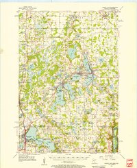
Editions of this 1974 Forest Lake Map
2 editions found
Other maps of this area

1902 · White Bear
USGS Topo · 1:62,500

1948 · Stillwater
USGS Topo · 1:62,500

1949 · Stillwater
USGS Topo · 1:62,500
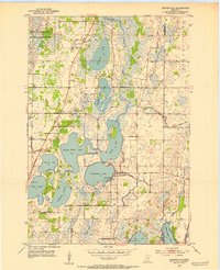
1952 · Centerville
USGS Topo · 1:24,000

1953 · Stillwater
USGS Topo · 1:250,000
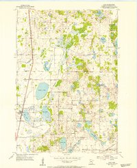
1954 · Hugo
USGS Topo · 1:24,000
1955 · Marine
USGS Topo · 1:24,000
1955 · Forest Lake
USGS Topo · 1:62,500
1955 · Isanti
USGS Topo · 1:62,500
1955 · New Brighton
USGS Topo · 1:62,500