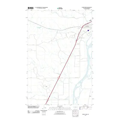
2011 Map of Forest Park
USGS Topo · Published 2011About this map
The Yellowstone River winds through the eastern edge of this landscape, defining the character of the river valley as it transitions into the upland plains of Dawson County. Centered on the communities of Forest Park and West Glendive, the area shows a distinct mid-century and modern residential layout contrasted against the long-standing industrial presence of the Glendive Oil Field to the southwest. To the south lies the small settlement of Colgate, situated near the riverbanks.
Find a feature on this map
27 named features on this map. Tap any name to fly to it.
Don’t see what you’re looking for? This feature index may not catch every label — zoom into the map to look around manually.
Map Details
Editions of this 2011 Forest Park Map
This is the sole edition of this map. No revisions or reprints were ever made.
Other maps of this area

1909 · Glendive
USGS Topo · 1:250,000

1953 · Miles City
USGS Topo · 1:250,000

1954 · Glendive
USGS Topo · 1:250,000

1957 · Miles City
USGS Topo · 1:250,000

1957 · Glendive
USGS Topo · 1:250,000

1958 · Miles City
USGS Topo · 1:250,000

1958 · Glendive
USGS Topo · 1:250,000

1967 · Stipek
USGS Topo · 1:24,000

1967 · Marsh
USGS Topo · 1:24,000

1967 · Hoyt
USGS Topo · 1:24,000