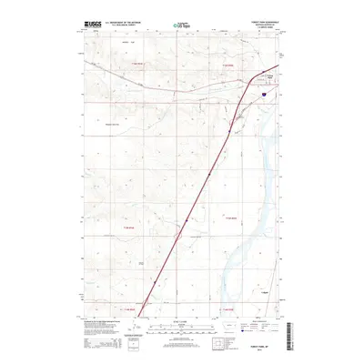
2014 Map of Forest Park
USGS Topo · Published 2014About this map
Forest Park sits at the edge of the Yellowstone River in this 2014 survey, serving as a residential anchor just north of the Dawson Memorial Cem. The landscape transitions from the river valley into the vast benchlands of Poverty Flat and Pleasant View Flat, where a network of county roads like Seven Mile Dr and Dry Creek Rd cross the rolling terrain. This area is defined by its drainage systems, including Upper Sevenmile Cr and Sand Cr, which carve through the plains toward the river. To the south, the industrial presence of the Glendive Oil Field underscores the region's energy economy, while the small settlement of Colgate remains marked near the riverbanks. The map documents the modern infrastructure of the Interstate 94 corridor and various local spurs like I-94 BR, reflecting the late-20th-century development of this eastern Montana gateway.
Find a feature on this map
39 named features on this map. Tap any name to fly to it.
Don’t see what you’re looking for? This feature index may not catch every label — zoom into the map to look around manually.
Map Details
Editions of this 2014 Forest Park Map
This is the sole edition of this map. No revisions or reprints were ever made.
Other maps of this area

1909 · Glendive
USGS Topo · 1:250,000

1953 · Miles City
USGS Topo · 1:250,000

1954 · Glendive
USGS Topo · 1:250,000

1957 · Miles City
USGS Topo · 1:250,000

1957 · Glendive
USGS Topo · 1:250,000

1958 · Miles City
USGS Topo · 1:250,000

1958 · Glendive
USGS Topo · 1:250,000

1967 · Stipek
USGS Topo · 1:24,000

1967 · Marsh
USGS Topo · 1:24,000

1967 · Hoyt
USGS Topo · 1:24,000