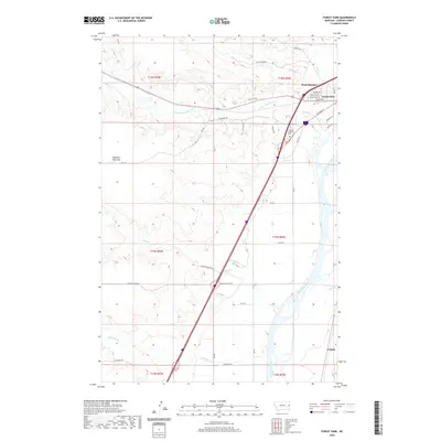
2020 Map of Forest Park
USGS Topo · Published 2020About this map
The Yellowstone River cuts a wide path through this Dawson County landscape, separating the established residential pockets of West Glendive and Forest Park from the open plains of Pleasant View Flat. The 2020 layout reveals a sophisticated irrigation and drainage network essential to this semi-arid region, featuring the Main Siphon Canal and numerous creeks such as Upper Sevenmile Cr, Sand Cr, and Whoopup Cr. Cultural markers like the Dawson Memorial Cem and the small settlement of Colgate to the south anchor the local geography. A dense grid of roads, including Old Hwy 200 and Seven Mile Dr, indicates the expansion of West Glendive's suburbs and their relationship to the historical transportation corridors following the river valley.
Find a feature on this map
42 named features on this map. Tap any name to fly to it.
Don’t see what you’re looking for? This feature index may not catch every label — zoom into the map to look around manually.
Map Details
Editions of this 2020 Forest Park Map
This is the sole edition of this map. No revisions or reprints were ever made.
Other maps of this area

1909 · Glendive
USGS Topo · 1:250,000

1953 · Miles City
USGS Topo · 1:250,000

1954 · Glendive
USGS Topo · 1:250,000

1957 · Miles City
USGS Topo · 1:250,000

1957 · Glendive
USGS Topo · 1:250,000

1958 · Miles City
USGS Topo · 1:250,000

1958 · Glendive
USGS Topo · 1:250,000

1967 · Stipek
USGS Topo · 1:24,000

1967 · Marsh
USGS Topo · 1:24,000

1967 · Hoyt
USGS Topo · 1:24,000