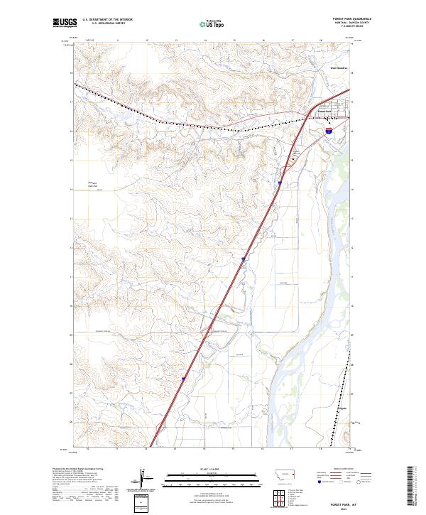
2024 Map of Forest Park
USGS Topo · Published 2024About this map
The Yellowstone River corridor dominates this map of eastern Montana, where the interplay between upland plateaus and river bottomlands defines the local geography. The community of West Glendive sits at the northern edge, bordered by the residential pocket of Forest Park. To the south, the settlement of Colgate marks the lower reaches of the river valley. A significant engineering feature, the Main Siphon Canal, cuts a straight line across the landscape, crossing both Sand Creek and the drainage of Whooppup Creek. This infrastructure serves the agricultural lands near the river, while the higher terrain to the west is characterized by broad areas like Pleasant View Flat. Local history is anchored by the Dawson Memorial Cem, situated near the confluence of Upper Sevenmile Creek and the main river valley.
Find a feature on this map
31 named features on this map. Tap any name to fly to it.
Don’t see what you’re looking for? This feature index may not catch every label — zoom into the map to look around manually.
Map Details
Editions of this 2024 Forest Park Map
This is the sole edition of this map. No revisions or reprints were ever made.
Other maps of this area

1909 · Glendive
USGS Topo · 1:250,000

1953 · Miles City
USGS Topo · 1:250,000

1954 · Glendive
USGS Topo · 1:250,000

1957 · Miles City
USGS Topo · 1:250,000

1957 · Glendive
USGS Topo · 1:250,000

1958 · Miles City
USGS Topo · 1:250,000

1958 · Glendive
USGS Topo · 1:250,000

1967 · Stipek
USGS Topo · 1:24,000

1967 · Marsh
USGS Topo · 1:24,000

1967 · Hoyt
USGS Topo · 1:24,000