
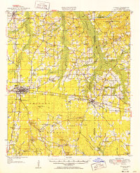
1952 Map of Forest
USGS Topo · Published 1952About this map
The Forest area of Scott and Newton Counties is anchored by the crossing of the Illinois Central Railroad and the sprawling woodlands of the Bienville National Forest. This mid-century revision shows a rural landscape densely populated with small agrarian communities and family-named landmarks. Notable gathering points like the Patrons Union Campground and Singleton Settlement indicate a social structure deeply tied to local institutions, while a high concentration of country schools, such as Piney Grove Sch. and Ringold Sch., and churches like Ephesis Ch. suggest the distribution of residents across the hills long before significant urbanization.
Find a feature on this map
92 named features on this map. Tap any name to fly to it.
Don’t see what you’re looking for? This feature index may not catch every label — zoom into the map to look around manually.
Map Details
Editions of this 1952 Forest Map
2 editions found
Other maps of this area

1921 · Forest
USGS Topo · 1:48,000

1922 · Forest
USGS Topo · 1:62,500

1922 · Morton
USGS Topo · 1:48,000

1924 · Morton
USGS Topo · 1:62,500

1950 · Forest
USGS Topo · 1:62,500

1951 · Morton
USGS Topo · 1:62,500

1953 · Meridian
USGS Topo · 1:250,000

1957 · Meridian
USGS Topo · 1:250,000

1961 · Carthage
USGS Topo · 1:62,500

1965 · Meridian
USGS Topo · 1:250,000