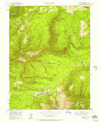
1949 Map of Foresthill
USGS Topo · Published 1957About this map
Foresthill and the Forest Hill Divide dominate this landscape, illustrating the intense gold-mining legacy of Placer County. This 1949 field survey records an intricate network of hydraulic and hard-rock operations, from the Iowa Hill Mine and California Morning Star Mine in the northwest to the Paragon Mine and Baltimore Mine further south. The map captures the rugged ridge-top settlements and the deep canyons of the North Fork American River and Middle Fork American River.
Find a feature on this map
75 named features on this map. Tap any name to fly to it.
Don’t see what you’re looking for? This feature index may not catch every label — zoom into the map to look around manually.
Map Details
Editions of this 1949 Foresthill Map
4 editions found
Other maps of this area

1891 · Colfax
USGS Topo · 1:125,000

1891 · Placerville
USGS Topo · 1:125,000

1892 · Placerville
USGS Topo · 1:125,000

1892 · Colfax
USGS Topo · 1:125,000

1893 · Placerville
USGS Topo · 1:125,000

1894 · Colfax
USGS Topo · 1:125,000

1898 · Colfax
USGS Topo · 1:125,000

1900 · Colfax
USGS Topo · 1:125,000

1902 · Colfax
USGS Topo · 1:125,000

1938 · Colfax
USGS Topo · 1:125,000