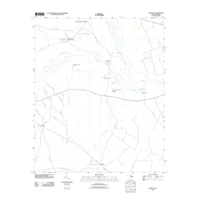
2011 Map of Foreston
USGS Topo · Published 2011About this map
Foreston and the surrounding Clarendon County lowlands are defined by the winding course of the Black River and the Pocotaligo River. In the early 21st century, the landscape is a mosaic of dense wetlands and managed water bodies, including Brewington Lake, Home Lake, and Martins Lake. Local history is anchored by rural communities like Wilson and Cypress Fork Crossroads, while the Foreston Lookout Tower stands as a prominent landmark in the southern reaches of the quadrangle. The map reveals the intricate drainage patterns of the area, where numerous streams like Broad Branch and Deep Creek feed into the larger river systems. Genealogists and researchers may find particular value in the location of the Brewington Cemetery near Brewington Crossing, providing a spatial link to the families who have long inhabited this riverine region.
Find a feature on this map
45 named features on this map. Tap any name to fly to it.
Don’t see what you’re looking for? This feature index may not catch every label — zoom into the map to look around manually.
Map Details
Editions of this 2011 Foreston Map
This is the sole edition of this map. No revisions or reprints were ever made.
Other maps of this area

1920 · Mayesville
USGS Topo · 1:48,000

1920 · Manning
USGS Topo · 1:48,000

1921 · Manning
USGS Topo · 1:62,500

1921 · Mayesville
USGS Topo · 1:62,500

1943 · Mayesville
USGS Topo · 1:62,500

1944 · Manning
USGS Topo · 1:62,500

1946 · Kingstree
USGS Topo · 1:62,500

1946 · Lake City
USGS Topo · 1:62,500

1949 · Georgetown
USGS Topo · 1:250,000

1954 · Augusta
USGS Topo · 1:250,000