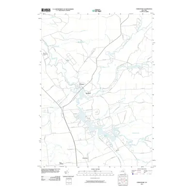
2010 Map of Forestport
USGS Topo · Published 2010About this map
Forestport serves as the focal point of this Adirondack foothills landscape, where the Black River and Woodhull Creek converge near the Alder Pond dam. The early 21st-century topography reveals a complex network of water and local industry, featuring the historic Bardwell Mill on Baker Brook and the Boonville Incorporated Airport to the northwest. To the south, Kayuta Lake dominates the terrain, fed by several tributaries including Gulf Creek and Indian Creek. Traces of earlier settlements and community life are visible through the Catholic Cemetery and smaller hamlets such as Woodhull and Honnedaga. The geography is further defined by natural landmarks like Crandall Falls on the Little Black Creek and the expansive Tamarack Swamp, illustrating the transition from managed rural lands to the dense hydrology of the New York interior.
Find a feature on this map
76 named features on this map. Tap any name to fly to it.
Don’t see what you’re looking for? This feature index may not catch every label — zoom into the map to look around manually.
Map Details
Editions of this 2010 Forestport Map
This is the sole edition of this map. No revisions or reprints were ever made.
Other maps of this area

1897 · Remsen
USGS Topo · 1:62,500

1900 · Remsen
USGS Topo · 1:62,500

1904 · Boonville
USGS Topo · 1:62,500

1905 · Port Leyden
USGS Topo · 1:62,500

1907 · Port Leyden
USGS Topo · 1:62,500

1912 · Mc Keever
USGS Topo · 1:62,500

1940 · Port Leyden
USGS Topo · 1:62,500

1945 · Boonville
USGS Topo · 1:24,000

1945 · Forestport
USGS Topo · 1:24,000
1946 · Hinckley
USGS Topo · 1:25,000