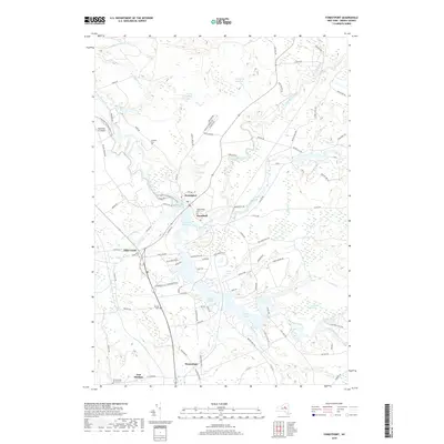
2019 Map of Forestport
USGS Topo · Published 2019About this map
Forestport and the surrounding Oneida County landscape are defined by a complex network of waterways where the Black River meets Woodhull Creek. The hydrology of the region is punctuated by the significant footprint of the Forestport Reservoir and the expansive Kayuta Lake to the south. This area demonstrates a legacy of rural infrastructure, with small settlements like Alder Creek, Woodhull, and Honnedaga connected by historical routes such as Old Stage Road B and the N Country National Scenic Trail.
Find a feature on this map
101 named features on this map. Tap any name to fly to it.
Don’t see what you’re looking for? This feature index may not catch every label — zoom into the map to look around manually.
Map Details
Editions of this 2019 Forestport Map
This is the sole edition of this map. No revisions or reprints were ever made.
Other maps of this area

1897 · Remsen
USGS Topo · 1:62,500

1900 · Remsen
USGS Topo · 1:62,500

1904 · Boonville
USGS Topo · 1:62,500

1905 · Port Leyden
USGS Topo · 1:62,500

1907 · Port Leyden
USGS Topo · 1:62,500

1912 · Mc Keever
USGS Topo · 1:62,500

1940 · Port Leyden
USGS Topo · 1:62,500

1945 · Boonville
USGS Topo · 1:24,000

1945 · Forestport
USGS Topo · 1:24,000
1946 · Hinckley
USGS Topo · 1:25,000