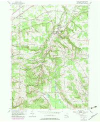
1954 Map of Forestville
USGS Topo · Published 1979About this map
Walnut Creek and the Erie RR corridor anchor this mid-century survey of northeastern Chautauqua County, where the village of Forestville sits at the nexus of the towns of Hanover, Sheridan, Villenova, and Arkwright. The landscape is a distinct network of early rural settlements and namesake intersections, including Chicken Tavern Corners, Keaches Corners, and Hawkins Corner. The map captures a transitional era for rural education and community infrastructure, recording numerous district schools like School No 6 and School No 10, along with ancestral burial grounds such as Pioneer Cem and Abbey Cem. The southern reach of the quadrangle rises toward Pope Hill and Round Top Hill, where the headwaters of the West Branch Conewango Creek emerge near West Mud Lake. This document provides a look at the region’s topography just before the widespread consolidation of many small crossroads communities.
Find a feature on this map
65 named features on this map. Tap any name to fly to it.
Don’t see what you’re looking for? This feature index may not catch every label — zoom into the map to look around manually.
Map Details
Editions of this 1954 Forestville Map
Other maps of this area

1899 · Silver Creek
USGS Topo · 1:62,500

1900 · Dunkirk
USGS Topo · 1:62,500

1900 · Cherry Creek
USGS Topo · 1:62,500

1941 · Cherry Creek
USGS Topo · 1:62,500

1943 · Dunkirk
USGS Topo · 1:62,500

1943 · Silver Creek
USGS Topo · 1:24,000

1944 · Farnham
USGS Topo · 1:31,680

1944 · Silver Creek
USGS Topo · 1:31,680
1954 · Hamlet
USGS Topo · 1:24,000

1954 · Forestville
USGS Topo · 1:24,000