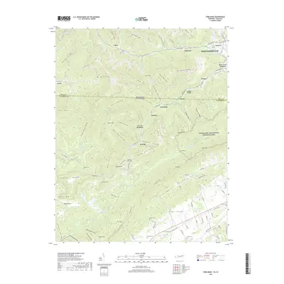
2019 Map of Fork Ridge
USGS Topo · Published 2019About this map
Cumberland Gap National Historical Park anchors the eastern edge of this 2019 survey, where the rugged topography of the Mingo Mountains and Log Mountains meets the urban edge of Middlesborough. The landscape is a complex network of high ridges like Malden Ridge and deep hollows, reflecting a history of resource extraction and transit. Settlements such as Manring, Fork Ridge, and Stony Fork Junction follow the narrow valley floors, while the Kentucky Tennessee state line traces the high ground. Local genealogy is well-preserved through numerous family burial sites, including Hatfield Cem, Watson Cem, and Rodgers Cem. The map also illustrates modern recreational use with the winding path of the Cumberland Trail traversing the Powell Valley and rising toward Big Coal Gap.
Find a feature on this map
133 named features on this map. Tap any name to fly to it.
Don’t see what you’re looking for? This feature index may not catch every label — zoom into the map to look around manually.
Map Details
Editions of this 2019 Fork Ridge Map
This is the sole edition of this map. No revisions or reprints were ever made.
Other maps of this area

1886 · Cumberland Gap
USGS Topo · 1:125,000

1888 · Cumberland Gap
USGS Topo · 1:125,000

1891 · Cumberland Gap
USGS Topo · 1:125,000

1897 · Maynardville
USGS Topo · 1:125,000

1900 · Maynardville
USGS Topo · 1:125,000

1903 · Middlesboro
USGS Topo · 1:48,000

1927 · Middlesboro
USGS Topo · 1:62,500

1930 · Middlesboro
USGS Topo · 1:62,500

1935 · Mingo Mountains
USGS Topo · 1:24,000

1935 · Cumberland Gap
USGS Topo · 1:24,000