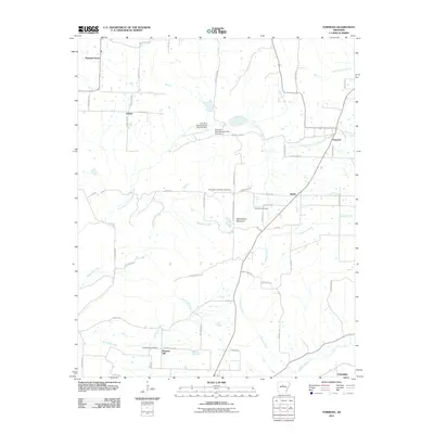
2011 Map of Formosa
USGS Topo · Published 2011About this map
Woolverton Mountain serves as a prominent geographic anchor in this section of Van Buren County, surrounded by rural settlements that define the local landscape. Small communities such as Formosa, Claude, and Austin are connected by a network of winding roads, including Woolverton Mountain Rd and Austin Rd. The hydrology of the area is shaped by the East Fork Point Remove Creek, where the East Fork Point Remove Site One Dam and its secondary counterpart manage the drainage system near the center of the sheet. For those researching local lineages, the map identifies essential sites like the Woolverton Mountain Cemetery, Halbrooks Cemetery, and Pleasant Hill Cemetery. These locations, alongside the dispersed hamlets of Pleasant Hill and Pleasant Grove, reflect a traditional Ozark plateau settlement pattern where life follows the paths of Hogans Creek and Sunnyside Creek.
Find a feature on this map
54 named features on this map. Tap any name to fly to it.
Don’t see what you’re looking for? This feature index may not catch every label — zoom into the map to look around manually.
Map Details
Editions of this 2011 Formosa Map
This is the sole edition of this map. No revisions or reprints were ever made.
Other maps of this area

1892 · Marshall
USGS Topo · 1:125,000

1892 · Mountain View
USGS Topo · 1:125,000

1892 · Morrillton
USGS Topo · 1:125,000

1894 · Mountain View
USGS Topo · 1:125,000

1894 · Morrillton
USGS Topo · 1:125,000

1894 · Marshall
USGS Topo · 1:125,000

1901 · Marshall
USGS Topo · 1:125,000

1956 · Russellville
USGS Topo · 1:250,000

1961 · Bee Branch
USGS Topo · 1:62,500

1961 · Bee Branch
USGS Topo · 1:24,000