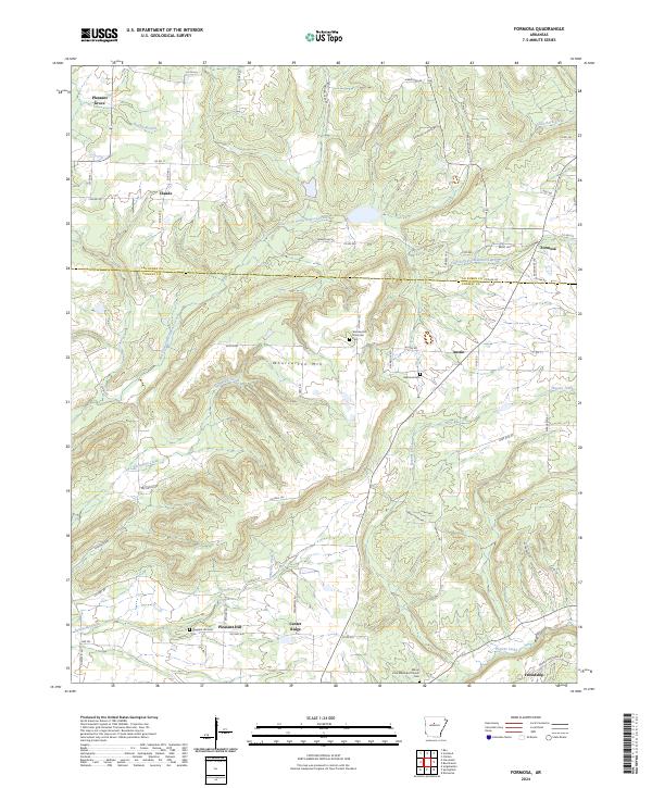
2024 Map of Formosa
USGS Topo · Published 2024About this map
Woolverton Mountain serves as a central topographical anchor in this modern survey of north-central Arkansas. The landscape is defined by the winding course of East Fork Point Remove Creek and its many tributaries, including Sheepskin Creek and Hogans Creek. The rural settlement pattern here is characterized by small, dispersed communities like Claude, Formosa, and Center Ridge, many of which developed around family-named landmarks and country churches. The presence of multiple burial grounds, such as Halbrook Cem and the Woolverton Mountain Cem, indicates a deeply rooted community structure and offers significant value for genealogical research. The boundary line between Van Buren and Conway counties bisects the quadrangle, illustrating how these high-elevation ridges dictated political and social divisions in the region. This 2024 data highlights the intersection of modern road networks with traditional settlements like Pleasant Hill and Friendship.
Find a feature on this map
67 named features on this map. Tap any name to fly to it.
Don’t see what you’re looking for? This feature index may not catch every label — zoom into the map to look around manually.
Map Details
Editions of this 2024 Formosa Map
This is the sole edition of this map. No revisions or reprints were ever made.
Other maps of this area

1892 · Marshall
USGS Topo · 1:125,000

1892 · Mountain View
USGS Topo · 1:125,000

1892 · Morrillton
USGS Topo · 1:125,000

1894 · Mountain View
USGS Topo · 1:125,000

1894 · Morrillton
USGS Topo · 1:125,000

1894 · Marshall
USGS Topo · 1:125,000

1901 · Marshall
USGS Topo · 1:125,000

1956 · Russellville
USGS Topo · 1:250,000

1961 · Bee Branch
USGS Topo · 1:62,500

1961 · Bee Branch
USGS Topo · 1:24,000