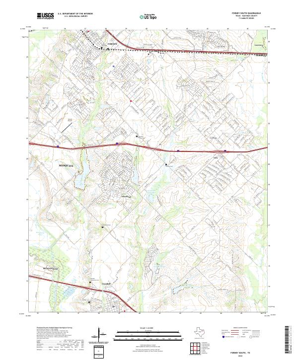
2022 Map of Forney South
USGS Topo · Published 2022About this map
Forney and Crandall anchor this portion of Kaufman County, where the landscape transitions from established towns to developing suburban enclaves like Heartland. The topography is defined by the drainage systems of Mustang Creek and Buffalo Creek, which feed into the East Fork Trinity River along the western edge. This modern survey illustrates the proximity of historical burial grounds to contemporary residential growth, preserving the locations of Lone Elm - Shipley Cem and Blackland Cem. These small cemeteries, along with Antioch Cem, serve as quiet markers of the area's rural ancestry amidst the expanding road networks of Old Us HWY 80 and W Us HWY 175. Regional connectivity is further highlighted by the Sunset Airport and the elevated terrain of Irish Ridge, providing a clear view of the infrastructure and land use in this North Texas corridor.
Find a feature on this map
28 named features on this map. Tap any name to fly to it.
Don’t see what you’re looking for? This feature index may not catch every label — zoom into the map to look around manually.
Map Details
Editions of this 2022 Forney South Map
This is the sole edition of this map. No revisions or reprints were ever made.
Other maps of this area

1891 · Dallas
USGS Topo · 1:125,000

1893 · Dallas
USGS Topo · 1:125,000

1919 · Royse City
USGS Topo · 1:62,500

1954 · Dallas
USGS Topo · 1:250,000

1956 · Kaufman
USGS Topo · 1:62,500

1958 · Dallas
USGS Topo · 1:250,000

1959 · Mesquite
USGS Topo · 1:24,000

1959 · Seagoville
USGS Topo · 1:24,000

1959 · India
USGS Topo · 1:24,000

1959 · Seagoville
USGS Topo · 1:62,500