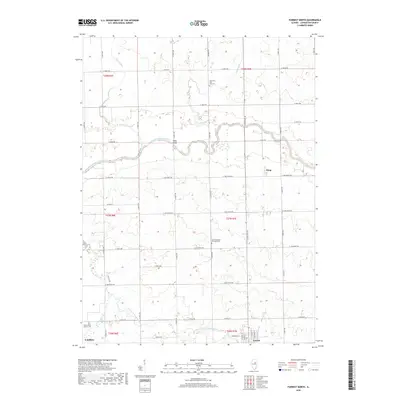
2018 Map of Forrest North
USGS Topo · Published 2018About this map
The North Fork Vermilion River and South Fork Vermilion River carve a meandering path through this Livingston County landscape, defining the rural character between the communities of Fairbury and Forrest. This 2018 survey reveals a terrain dominated by a systematic grid of agricultural roads, such as N 2500 E Rd and E 1200 North Rd, punctuated by landmarks of local heritage. Significant for genealogical research, the map identifies the Saunemin Five Mile Cem, the North Apostolic Christian Cem, and Saint John's Catholic Cem near the southern boundary. The small settlement of Wing sits nestled along the eastern edge, while the Vieley Bridge provides a documented crossing of the North Fork. Smaller tributaries like Fivemile Cr, Indian Cr, and the appropriately named Felky Slough further articulate the drainage patterns of this central Illinois prairie land.
Find a feature on this map
47 named features on this map. Tap any name to fly to it.
Don’t see what you’re looking for? This feature index may not catch every label — zoom into the map to look around manually.
Map Details
Editions of this 2018 Forrest North Map
This is the sole edition of this map. No revisions or reprints were ever made.
Other maps of this area

1935 · Pontiac
USGS Topo · 1:62,500

1939 · Pontiac
USGS Topo · 1:62,500

1947 · Sibley
USGS Topo · 1:62,500

1947 · Cullom
USGS Topo · 1:62,500

1949 · Cullom
USGS Topo · 1:62,500

1949 · Sibley
USGS Topo · 1:62,500

1957 · Colfax
USGS Topo · 1:62,500

1958 · Peoria
USGS Topo · 1:250,000

1961 · Peoria
USGS Topo · 1:250,000

1963 · Peoria
USGS Topo · 1:250,000