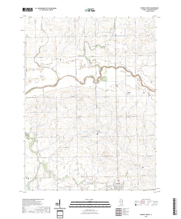
2024 Map of Forrest North
USGS Topo · Published 2024About this map
Forrest sits at the southern edge of this Livingston County landscape, where the local grid meets the winding course of the South Fork Vermilion River. The area is defined by a dense network of agricultural roads and the hydrology of the prairie, including the meandering paths of Fivemile Creek and Felky Slough. Further north, the settlement of Wing and the small grove at Five Mile Grove provide distinct historical reference points for researchers. Genealogy interests are well-served by the presence of three burial sites: Five Mile Cem, the North Apostolic Christian Cem, and Saint Johns Cem near the river. The contrast between the rigid sectional road system and the erratic oxbows of the North Fork Vermilion River illustrates how the natural water systems shaped the placement of late-era settlements and farming plots.
Find a feature on this map
40 named features on this map. Tap any name to fly to it.
Don’t see what you’re looking for? This feature index may not catch every label — zoom into the map to look around manually.
Map Details
Editions of this 2024 Forrest North Map
This is the sole edition of this map. No revisions or reprints were ever made.
Other maps of this area

1935 · Pontiac
USGS Topo · 1:62,500

1939 · Pontiac
USGS Topo · 1:62,500

1947 · Sibley
USGS Topo · 1:62,500

1947 · Cullom
USGS Topo · 1:62,500

1949 · Cullom
USGS Topo · 1:62,500

1949 · Sibley
USGS Topo · 1:62,500

1957 · Colfax
USGS Topo · 1:62,500

1958 · Peoria
USGS Topo · 1:250,000

1961 · Peoria
USGS Topo · 1:250,000

1963 · Peoria
USGS Topo · 1:250,000