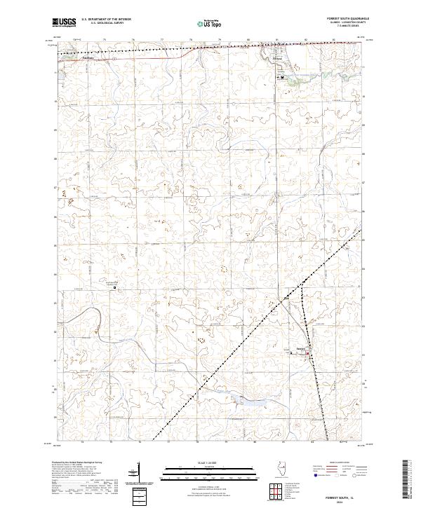
2024 Map of Forrest South
USGS Topo · Published 2024About this map
Indian Creek meanders through the fertile agricultural plains of Livingston County, defining a landscape shaped by a rigid grid of rural section roads. This survey of the region surrounding Fairbury and Forrest illustrates the enduring layout of Central Illinois farm country, where small rural hubs like Risk and Strawn are spaced along the transport corridors. The map provides significant detail for genealogists and local historians, particularly through its identification of burial sites and religious landmarks. Key sites include the South Apostolic Christian Cem and the Forrest Township Cem, which serve as permanent markers of the area's early settlement. Near the northern boundary, the South Fork Vermilion River cuts across the township lines, offering a brief departure from the geometric precision of the surrounding county roads.
Find a feature on this map
38 named features on this map. Tap any name to fly to it.
Don’t see what you’re looking for? This feature index may not catch every label — zoom into the map to look around manually.
Map Details
Editions of this 2024 Forrest South Map
This is the sole edition of this map. No revisions or reprints were ever made.
Other maps of this area

1935 · Pontiac
USGS Topo · 1:62,500

1939 · Pontiac
USGS Topo · 1:62,500

1947 · Sibley
USGS Topo · 1:62,500

1947 · Cullom
USGS Topo · 1:62,500

1949 · Cullom
USGS Topo · 1:62,500

1949 · Sibley
USGS Topo · 1:62,500

1957 · Colfax
USGS Topo · 1:62,500

1958 · Peoria
USGS Topo · 1:250,000

1961 · Peoria
USGS Topo · 1:250,000

1963 · Peoria
USGS Topo · 1:250,000