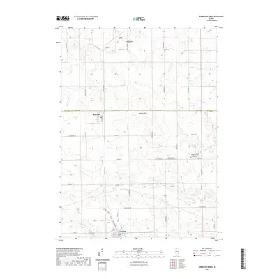
2021 Map of Forreston North
USGS Topo · Published 2021About this map
Leaf River and Elkhorn Cr meander through the rural landscape of Ogle and Stephenson Counties, defining the drainage patterns south of South Freeport. The terrain is punctuated by Hardpan Ridge and the distinct elevation of Coffman Bluff, providing a clear view of the agricultural character of this region in the early twenty-first century. Small clusters of settlement such as Baileyville and the northern edge of Forreston are connected by a network of rural roads like S Baileyville Rd and W Montague Rd. Genealogists will find several notable burial sites including Cranes Grove Cem, White Oak Cem, and the North Grove Zion Reformed Cem. This survey also documents transportation infrastructure ranging from the runways at Albertus Airport to the path of N State Rte 26, reflecting the modern layout of these Illinois townships.
Find a feature on this map
51 named features on this map. Tap any name to fly to it.
Don’t see what you’re looking for? This feature index may not catch every label — zoom into the map to look around manually.
Map Details
Editions of this 2021 Forreston North Map
This is the sole edition of this map. No revisions or reprints were ever made.
Other maps of this area

1922 · Oregon
USGS Topo · 1:62,500

1924 · Oregon
USGS Topo · 1:62,500

1932 · Pecatonica
USGS Topo · 1:62,500

1936 · Pecatonica
USGS Topo · 1:62,500

1939 · Freeport
USGS Topo · 1:48,000

1942 · Forreston
USGS Topo · 1:62,500

1944 · Freeport
USGS Topo · 1:62,500

1945 · Forreston
USGS Topo · 1:62,500

1954 · Rockford
USGS Topo · 1:250,000

1955 · Rockford
USGS Topo · 1:250,000