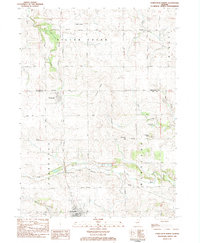
1983 Map of Forreston North
USGS Topo · Published 1984About this map
Forreston sits at the southern edge of this northern Illinois landscape, where the Chicago Milwaukee St Paul and Pacific rail line cuts across the prairie. The map documents a rural corridor stretching from the outskirts of South Freeport down toward the Ogle County line, marked by long-established family farmsteads and a grid of country roads like German Valley Road and Montague Road. The terrain is defined by the winding course of Silver Creek and the Leaf River, with notable elevations at Hardpan Ridge and Coffman Bluff overlooking the water.
Find a feature on this map
46 named features on this map. Tap any name to fly to it.
Don’t see what you’re looking for? This feature index may not catch every label — zoom into the map to look around manually.
Map Details
Editions of this 1983 Forreston North Map
This is the sole edition of this map. No revisions or reprints were ever made.
Other maps of this area

1922 · Oregon
USGS Topo · 1:62,500

1924 · Oregon
USGS Topo · 1:62,500

1932 · Pecatonica
USGS Topo · 1:62,500

1936 · Pecatonica
USGS Topo · 1:62,500

1939 · Freeport
USGS Topo · 1:48,000

1942 · Forreston
USGS Topo · 1:62,500

1944 · Freeport
USGS Topo · 1:62,500

1945 · Forreston
USGS Topo · 1:62,500

1954 · Rockford
USGS Topo · 1:250,000

1955 · Rockford
USGS Topo · 1:250,000