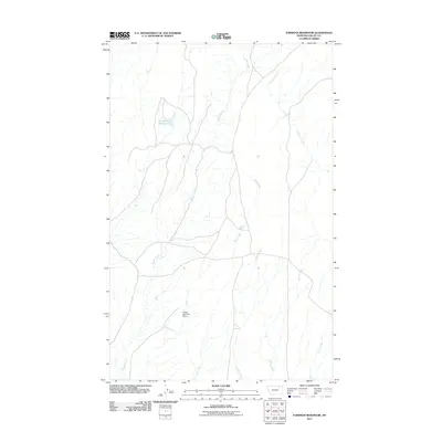
2011 Map of Forsman Reservoir
USGS Topo · Published 2011About this map
Buggy Creek and its many winding tributaries define this portion of Valley County, Montana. The landscape is dominated by the complex drainage systems of Wolf Creek, Crooked Creek, and Dry Fork Creek, illustrating the intricate water management required in this arid region. A primary focal point is the Forsman Reservoir, a critical water resource for local ranching and agriculture. Further south, the Buggy Reservoir Dam marks another significant piece of rural infrastructure, managing the flow of seasonal runoff. This survey provides a precise look at the hydrology of the plains, where small named waterways like Spring Creek and Cherry Creek carve paths through the open country. The network of unimproved roads and 4WD tracks shown connecting these water sources reflects the practical geography of modern Montana range land.
Find a feature on this map
8 named features on this map. Tap any name to fly to it.
Don’t see what you’re looking for? This feature index may not catch every label — zoom into the map to look around manually.
Map Details
Editions of this 2011 Forsman Reservoir Map
This is the sole edition of this map. No revisions or reprints were ever made.
Other maps of this area

1919 · Boundary
USGS Topo · 1:125,000

1943 · Glasgow
USGS Topo · 1:125,000

1954 · Glasgow
USGS Topo · 1:250,000

1957 · Glasgow
USGS Topo · 1:250,000

1958 · Glasgow
USGS Topo · 1:250,000

1969 · Cornwell Reservoir
USGS Topo · 1:24,000

1969 · Chapman Coulee NE
USGS Topo · 1:24,000
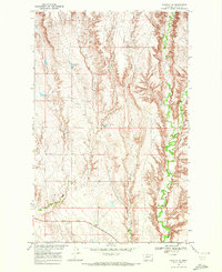
1969 · Tampico NE
USGS Topo · 1:24,000

1984 · Laundry Hill
USGS Topo · 1:24,000

1984 · Opheim
USGS Topo · 1:100,000