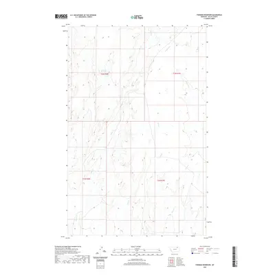
2020 Map of Forsman Reservoir
USGS Topo · Published 2020About this map
Forsman Reservoir serves as a focal point in this portion of Valley County, Montana, situated within the drainage systems that define this part of the northern plains. The landscape is marked by a complex network of seasonal and perennial waterways, including Buggy Cr and Dry Fork Cr, which cut through the high prairie. The distribution of these water sources, alongside Wolf Cr and Crooked Cr, illustrates the vital infrastructure required for ranching and land management in this arid region. The lack of concentrated settlements or industrial development highlighted in this 2020 survey underscores the area's continued reliance on natural drainage and water storage. Mapping of Spring Cr and Cherry Cr further reveals the subtle topographic variations that dictate the flow of water across the open range, providing essential data for environmental and agricultural researchers.
Find a feature on this map
11 named features on this map. Tap any name to fly to it.
Don’t see what you’re looking for? This feature index may not catch every label — zoom into the map to look around manually.
Map Details
Editions of this 2020 Forsman Reservoir Map
This is the sole edition of this map. No revisions or reprints were ever made.
Other maps of this area

1919 · Boundary
USGS Topo · 1:125,000

1943 · Glasgow
USGS Topo · 1:125,000

1954 · Glasgow
USGS Topo · 1:250,000

1957 · Glasgow
USGS Topo · 1:250,000

1958 · Glasgow
USGS Topo · 1:250,000

1969 · Cornwell Reservoir
USGS Topo · 1:24,000

1969 · Chapman Coulee NE
USGS Topo · 1:24,000
1969 · Tampico NE
USGS Topo · 1:24,000

1984 · Laundry Hill
USGS Topo · 1:24,000

1984 · Opheim
USGS Topo · 1:100,000