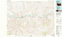
1979 Map of Forsyth
USGS Topo · Published 1979About this map
The Yellowstone River serves as the central artery for this 1979 survey of eastern Montana, where a network of coulees and creeks drains the high plains into a fertile valley. This landscape is defined by the dual presence of the Chicago Milwaukee St Paul and Pacific and the Burlington Northern railroads, which parallel the river and connect small rail-tied settlements like Rosebud and Hathaway. The map captures the infrastructure of the late 1970s, from the Rosebud State Rec Area near the county seat to the scattered Radio Towers and Gravel Pits that signal the region's industrial activity.
Find a feature on this map
75 named features on this map. Tap any name to fly to it.
Don’t see what you’re looking for? This feature index may not catch every label — zoom into the map to look around manually.
Map Details
Editions of this 1979 Forsyth Map
This is the sole edition of this map. No revisions or reprints were ever made.
Other maps of this area

1953 · Miles City
USGS Topo · 1:250,000

1954 · Hardin
USGS Topo · 1:250,000

1954 · Ekalaka
USGS Topo · 1:250,000

1954 · Forsyth
USGS Topo · 1:250,000

1956 · Ekalaka
USGS Topo · 1:250,000

1957 · Miles City
USGS Topo · 1:250,000

1957 · Hardin
USGS Topo · 1:250,000

1957 · Forsyth
USGS Topo · 1:250,000

1958 · Miles City
USGS Topo · 1:250,000

1958 · Ekalaka
USGS Topo · 1:250,000