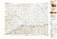
1983 Map of Forsyth
USGS Topo · Published 1983About this map
The Yellowstone River and the Burlington Northern railroad form the primary east-west corridor of this 1983 survey, anchoring a network of small ranching and rail settlements across Rosebud and Treasure Counties. The map reveals a landscape defined by dramatic geological breaks such as Gumbo Ridge and Rattlesnake Buttes, giving way to the productive grounds of Mission Valley and Sevenmile Flat.
Find a feature on this map
89 named features on this map. Tap any name to fly to it.
Don’t see what you’re looking for? This feature index may not catch every label — zoom into the map to look around manually.
Map Details
Editions of this 1983 Forsyth Map
This is the sole edition of this map. No revisions or reprints were ever made.
Other maps of this area

1893 · Huntley
USGS Topo · 1:125,000

1894 · Fort Custer
USGS Topo · 1:125,000

1953 · Miles City
USGS Topo · 1:250,000

1954 · Billings
USGS Topo · 1:250,000

1954 · Hardin
USGS Topo · 1:250,000

1954 · Jordan
USGS Topo · 1:250,000

1954 · Ekalaka
USGS Topo · 1:250,000

1954 · Forsyth
USGS Topo · 1:250,000

1954 · Roundup
USGS Topo · 1:250,000

1954 · Glendive
USGS Topo · 1:250,000