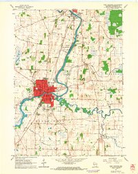
1961 Map of Fort Atkinson
USGS Topo · Published 1964About this map
The Rock River winds through the heart of this Jefferson County landscape, serving as the central axis for Fort Atkinson and Jefferson at a time of steady mid-century growth. The map illustrates the town's educational and civic infrastructure through features like the Barrie Sch, Vocational Sch, and High Sch, alongside the Fort Atkinson Municipal Airport. The industrial and logistics footprint of the era is clearly defined by the Chicago and North Western railroad lines and numerous Gravel Pits and Quarries that dot the townships of Koshkonong and Hebron.
Find a feature on this map
38 named features on this map. Tap any name to fly to it.
Don’t see what you’re looking for? This feature index may not catch every label — zoom into the map to look around manually.
Map Details
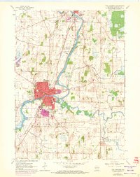
Editions of this 1961 Fort Atkinson Map
2 editions found
Other maps of this area

1891 · Waterloo
USGS Topo · 1:62,500

1891 · Koshkonong
USGS Topo · 1:62,500

1892 · Watertown
USGS Topo · 1:62,500

1892 · Whitewater
USGS Topo · 1:62,500

1893 · Whitewater
USGS Topo · 1:62,500

1894 · Waterloo
USGS Topo · 1:62,500

1894 · Watertown
USGS Topo · 1:62,500

1894 · Koshkonong
USGS Topo · 1:62,500

1903 · Whitewater
USGS Topo · 1:62,500

1906 · Koshkonong
USGS Topo · 1:62,500