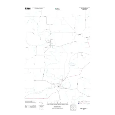
2013 Map of Fort Atkinson
USGS Topo · Published 2013About this map
The Turkey River winds through the heart of Winneshiek County, carving a valley that anchors the settlements of Spillville and Fort Atkinson. This modern geospatial record shows the enduring rural layout of the region, where the river's path is joined by numerous tributaries including Wonder Creek, Bohemian Creek, and Krumm Creek. The landscape is a network of county roads and local avenues, such as Co Hwy-W14 and Conover Road, that connect family farms and recreational areas like Lake Meyer.
Find a feature on this map
67 named features on this map. Tap any name to fly to it.
Don’t see what you’re looking for? This feature index may not catch every label — zoom into the map to look around manually.
Map Details
Editions of this 2013 Fort Atkinson Map
This is the sole edition of this map. No revisions or reprints were ever made.
Other maps of this area

1906 · Decorah
USGS Topo · 1:125,000

1954 · Mason City
USGS Topo · 1:250,000

1957 · Mason City
USGS Topo · 1:250,000

1958 · Mason City
USGS Topo · 1:250,000

1958 · La Crosse
USGS Topo · 1:250,000

1961 · La Crosse
USGS Topo · 1:250,000

1965 · La Crosse
USGS Topo · 1:250,000

1975 · Decorah 3 NW
USGS Topo · 1:24,000

1975 · Decorah 2 SW
USGS Topo · 1:24,000
1975 · Decorah 3 NE
USGS Topo · 1:24,000