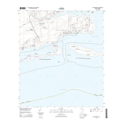
2015 Map of Fort Barrancas
USGS Topo · Published 2015About this map
Fort Barrancas stands as a focal point overlooking the waters where Pensacola Bay meets the Gulf of Mexico. This coastal landscape is dominated by the sprawling operations of the Pensacola Naval Air Station, featuring an extensive network of runways and a dedicated fuel farm. Across the Intracoastal Waterway on Santa Rosa Island, the historical grounds of Fort Pickens and the Chasefield Plantation Cemetery offer significant points for genealogical and historical research. Residential developments like Sherman Grove, Pleasant Grove, and Navy Point line the northern shores of Bayou Grande, while the southern reaches are protected as part of the Gulf Islands National Seashore. The map details a complex maritime environment of shifting sands and navigation hazards, including Caucus Shoal and the Middle Ground.
Find a feature on this map
93 named features on this map. Tap any name to fly to it.
Don’t see what you’re looking for? This feature index may not catch every label — zoom into the map to look around manually.
Map Details
Editions of this 2015 Fort Barrancas Map
This is the sole edition of this map. No revisions or reprints were ever made.
Other maps of this area

1921 · Pensacola
USGS Topo · 1:62,500

1921 · Fort Barrancas
USGS Topo · 1:62,500

1941 · Fort Barrancas
USGS Topo · 1:62,500

1941 · Pensacola
USGS Topo · 1:62,500

1942 · Pensacola
USGS Topo · 1:62,500

1943 · Fort Barrancas
USGS Topo · 1:62,500

1944 · Perdido Bay North
USGS Topo · 1:25,000

1944 · West Pensacola
USGS Topo · 1:25,000

1944 · Perdido Bay South
USGS Topo · 1:25,000

1944 · Gulf Breeze
USGS Topo · 1:25,000