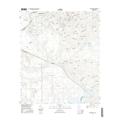
2017 Map of Fort Benning
USGS Topo · Published 2017About this map
The city of Columbus and the expansive military infrastructure of Lawson Army Airfield anchor the landscape along the Georgia-Alabama border. The Chattahoochee River carves a winding path through the center of this 2017 survey, separating Muscogee and Chattahoochee counties in Georgia from Russell County in Alabama. The terrain is defined by a dense concentration of named ridges and hills, such as Riche Hill, Sexton Ridge, and Running Ridge, which overlook a network of creeks including Oswichee Cr and Uchee Cr. The street grid of the southern portions of Columbus transitions into specialized military corridors like 1st Infantry Bde Loop and Gaines Cir. Local water bodies like Harps Pond and Russ Pond sit among the many tributaries feeding the primary river system.
Find a feature on this map
176 named features on this map. Tap any name to fly to it.
Don’t see what you’re looking for? This feature index may not catch every label — zoom into the map to look around manually.
Map Details
Editions of this 2017 Fort Benning Map
This is the sole edition of this map. No revisions or reprints were ever made.
Other maps of this area

1908 · Columbus
USGS Topo · 1:62,500

1914 · Seale
USGS Topo · 1:62,500

1929 · Columbus
USGS Topo · 1:48,000

1947 · Columbus
USGS Topo · 1:62,500

1949 · Fort Mitchell
USGS Topo · 1:24,000

1949 · Julia
USGS Topo · 1:24,000

1949 · Ochillee
USGS Topo · 1:24,000

1949 · Columbus
USGS Topo · 1:24,000

1949 · Cusseta
USGS Topo · 1:24,000

1950 · Fort Benning
USGS Topo · 1:24,000