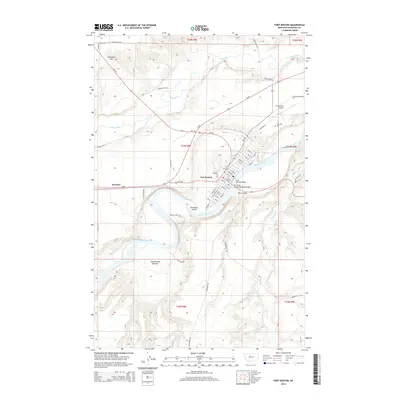
2014 Map of Fort Benton
USGS Topo · Published 2014About this map
The Missouri River carves a deep valley through this portion of Chouteau County, where the historic town of Fort Benton serves as a focal point for the region's transport and geography. The map illustrates the town's street grid, from 10th St up to 26th St, and the critical crossings provided by the Fort Benton Bridge and the Chouteau County Memorial Bridge. These spans connect the main settlement to Roosevelt Island and the south bank, while the northern outskirts are defined by the Teton River as it approaches its confluence with the Missouri.
Find a feature on this map
68 named features on this map. Tap any name to fly to it.
Don’t see what you’re looking for? This feature index may not catch every label — zoom into the map to look around manually.
Map Details
Editions of this 2014 Fort Benton Map
This is the sole edition of this map. No revisions or reprints were ever made.
Other maps of this area

1890 · Fort Benton
USGS Topo · 1:250,000

1892 · Fort Benton
USGS Topo · 1:250,000

1897 · Fort Benton
USGS Topo · 1:250,000

1953 · Tunis
USGS Topo · 1:24,000

1953 · O'Hanlon Coulee
USGS Topo · 1:24,000

1953 · Loma West
USGS Topo · 1:24,000

1954 · Great Falls
USGS Topo · 1:250,000

1954 · Rice Reservoir
USGS Topo · 1:24,000

1954 · Fort Benton
USGS Topo · 1:24,000

1956 · Highwood
USGS Topo · 1:62,500