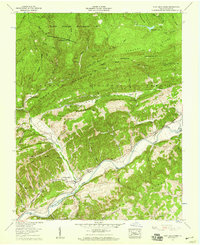
1957 Map of Fort Blackmore
USGS Topo · Published 1959About this map
Fort Blackmore serves as the focal point of this mid-century survey, situated along a prominent bend of the Clinch River in Scott County. The landscape is defined by the tight, parallel ridges of the Appalachian chain, including Stone Mountain and Buckner Ridge, which host a dense network of family cemeteries and small rural congregations. The presence of features like the Buckner Ridge Lookout Tower and the Glades Wildlife Management Area speaks to the region's managed timberlands and conservation efforts within the Jefferson National Forest.
Find a feature on this map
101 named features on this map. Tap any name to fly to it.
Don’t see what you’re looking for? This feature index may not catch every label — zoom into the map to look around manually.
Map Details
Editions of this 1957 Fort Blackmore Map
2 editions found

Other maps of this area

1894 · Estillville
USGS Topo · 1:125,000

1897 · Bristol
USGS Topo · 1:125,000

1902 · Bristol
USGS Topo · 1:125,000

1920 · Wise
USGS Topo · 1:48,000

1920 · Coeburn
USGS Topo · 1:48,000

1921 · Wise
USGS Topo · 1:62,500

1935 · Hilton
USGS Topo · 1:24,000
1935 · Wise
USGS Topo · 1:24,000

1935 · Moggasin
USGS Topo · 1:48,000
1935 · Norton
USGS Topo · 1:24,000