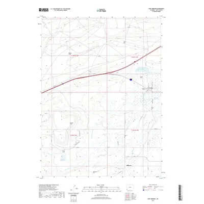
2017 Map of Fort Bridger
USGS Topo · Published 2017About this map
Fort Bridger and the nearby community of Millburne anchor this portion of Uinta County, where the high plains terrain is defined by significant landmarks like Bridger Butte and the Bigelow Bench. The landscape is a study in western water management, featuring a network of irrigation and storage systems including the Bridger Butte Canal, Cottonwood Reservoir, and the Wall Development Company Reservoir. These man-made features work alongside natural watercourses such as Blacks Fork and Quarry Cr to support the region's agricultural and ranching footprint.
Find a feature on this map
45 named features on this map. Tap any name to fly to it.
Don’t see what you’re looking for? This feature index may not catch every label — zoom into the map to look around manually.
Map Details
Editions of this 2017 Fort Bridger Map
This is the sole edition of this map. No revisions or reprints were ever made.
Other maps of this area

1954 · Ogden
USGS Topo · 1:250,000

1958 · Ogden
USGS Topo · 1:250,000

1960 · Ogden
USGS Topo · 1:250,000

1964 · Fort Bridger
USGS Topo · 1:24,000

1964 · Carter
USGS Topo · 1:24,000

1964 · Mountain View
USGS Topo · 1:24,000

1964 · Austin Reservoir
USGS Topo · 1:24,000
1964 · Leavitt Bench
USGS Topo · 1:24,000
1964 · Robertson
USGS Topo · 1:24,000

1965 · Bridger
USGS Topo · 1:24,000